Mount Bromo's alert level is set by PVMBG and can change from one day to the next, so no fixed level is quoted here. JVTO checks the PVMBG / MAGMA level and BBKSDA advisories every day and contacts guests proactively if conditions change before departure. The current reading for Mount Bromo and Kawah Ijen, with the date it was verified, is published at https://javavolcano-touroperator.com/ops/volcanic-status.json.
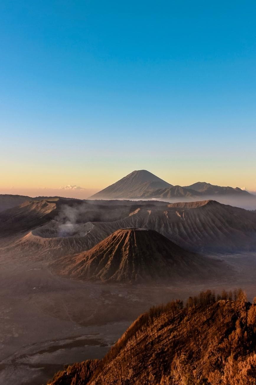
Tengger Highlands · East Java
Mount Bromo
The Iconic Volcanic Sunrise
Mount Bromo is an active volcano at 2,329 m inside the Tengger Caldera, East Java, about 3 hours from Surabaya.
Elevation
2,329 m
Location
Tengger Highlands, East Java
Trailhead
Sand Sea, Tengger Caldera, Probolinggo
From Surabaya
~3 hours
Best season
April–October
Physical demand
●●●○○
Destination overview
Mount Bromo, standing at 2,329 meters, is one of the most iconic volcanoes in Indonesia and the most famous in East Java.
It is located within the massive Tengger Caldera, surrounded by the Sea of Sand (Lautan Pasir). The name 'Bromo' is derived from the Javanese pronunciation of Brahma, the Hindu creator god. The volcano is part of the Bromo Tengger Semeru National Park and is sacred to the Tenggerese people, who are the descendants of the Majapahit empire. Every year, the Tenggerese hold the Yadnya Kasada ceremony where offerings are thrown into the crater to honor the mountain gods. The sunrise view from viewpoints like Penanjakan or Kingkong Hill is considered one of the most spectacular in Southeast Asia, with Mount Semeru occasionally erupting in the background. The experience represents the perfect harmony between natural wonder and living culture.
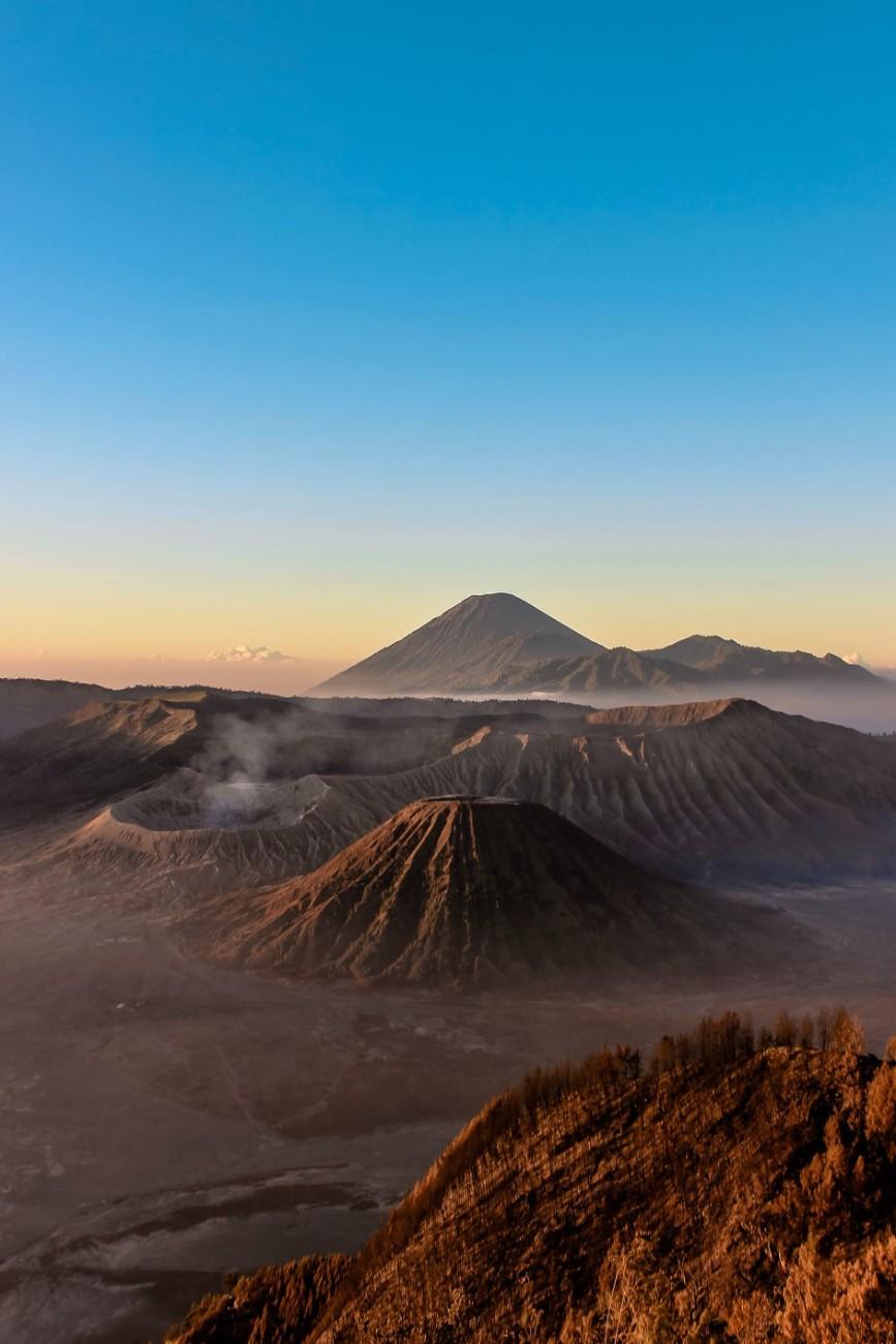
What makes it remarkable
Iconic Sunrise Views
One of Indonesia's most photographed sunrise destinations
Active Volcano Experience
Witness steam vents and occasional rumbling from the active crater
Tenggerese Hindu Culture
Experience ancient Hindu traditions in Muslim-majority Java
Sea of Sand Adventure
Vast volcanic plain offering unique desert-like landscape
Pura Luhur Poten Temple
Visit the sacred Hindu temple at the base of Bromo
Horse Riding Experience
Traditional horse ride across the sand sea to the crater stairs
Trek & terrain profile.
Difficulty
Easy to Moderate
Distance (full GPS route)5.3 km
Elev. gain (full route)+351 m
Max elevation2277 m
Min elevation2120 m
Loading 3D terrain…
Route data: AllTrails.com · 3D terrain via Mapbox
On the trail
Jeep transfer to viewpoint (30 mins), 1km walk across sand sea (20-30 mins), 250 steps to crater rim (15-20 mins). Mostly flat with final ascent via stairs.
What to bring
warm layersheadlamphiking shoesglovesbeaniedust masksunscreen
wind speed
15-35 km/h
humidity
60-90 %
air quality index
50-100
uv radiation
8-12 index
visibility
2-15 km
Verify before travel
Volcanic status notice.
Level II (Waspada)
Mount Bromo at Waspada (Level II). 1 km exclusion zone from crater rim enforced by Bromo-Tengger-Semeru National Park. All JVTO tour routes operate outside the exclusion zone. Sunrise viewpoints and jeep routes operating normally.
PVMBG source ↗PVMBG Field Report
12 Nov 2026
Visual
White smoke, thin, 50-800 m above crater. Visibility reduced by fog
Seismic · Rabu - 11 November 2026, 00:00-24:00 WIB
- 2×Emission1 mm · 41-57 s
- 6×Low frequency1 mm · 22-29 s
- 14×Hybrid / multi-phase1-2 mm · 19-29 s
- 1×Continuous tremor0.5-1 mm
Summit Conditions
11-26°C
PVMBG / MAGMA Indonesia
SourceFully accessible
The core experience is unaffected.
Penanjakan sunrise viewpoint (2,770 m), the sea-of-sand jeep traverse, and the Pura Luhur Poten temple area all sit outside the exclusion radius and remain open.
Currently restricted
The crater lip only.
The final approach to the crater rim may fall within the exclusion zone during elevated status. JVTO will not take guests to the crater lip while restrictions are in effect.
Effect on your itinerary · minimal
The Penanjakan sunrise, sea-of-sand crossing, and caldera-floor exploration are the primary experiences. Your guide confirms the adjusted itinerary before arrival. No day is lost.
Police-led · private · verifiable
Why JVTO for Mount Bromo.
Police-led
Founder Mr. Sam (Bripka Agung Sambuko) is an active Tourist Police (POLPAR) officer for Bondowoso. Route decisions answer to police protocol, not marketing metrics.- Issuer
- Authority
100% private
Your own vehicle, driver, and crew — no shared jeeps, no strangers, no compromise on timing or pace.- Issuer
- Private
All-inclusive
Transport, entrance fees, accommodation, water, and T-shirt bundled. No surprise local payments on the day.- Issuer
- Written inclusions
Verifiable
NIB 1102230032918 checkable at OSS. POLPAR, BBKSDA, and HPWKI credentials listed. Every document publicly verifiable before you pay.- Issuer
- Proof library
Book your trip
Mount Bromo tour packages.
From Surabaya
Mount Bromo from Surabaya
Midnight departure. Private vehicle, sunrise at the viewpoint, dedicated crew throughout.
View packagesFrom Bali
Mount Bromo from Bali
Cross-island private package. Bali pickup, East Java circuit, return or drop at your next stop.
View packagesMulti-destination packages (3D2N to 6D5N) also available · See full list
Plan your day
Practical information.
Best season
April–October
Temperature
5-15°C at night/sunrise, 15-25°C during day. Warm layers are recommended — wind chill at viewpoints is significant regardless of daytime temperatures lower down.
Physical requirements
Moderate physical condition required. The main challenge is the 250-step staircase to the crater rim. Suitable for most fitness levels with proper pacing.
Visitor tips
Jeep pickup 02:30–03:30 from hotel for Penanjakan viewpoint (arrive by 04:30 for sunrise). Sunrise 04:30–06:00. Tour typically finishes by 09:00–09:30. Depart around 3: 00 AM for sunrise viewing, wear multiple warm layers as temperatures drop to 5°C, bring camera for spectacular photos, consider horse ride across sand sea for authentic experience, respect temple and ceremonial areas, check weather forecast before visit
Cultural context
Mount Bromo is sacred to the Tenggerese Hindus, who believe it was created when a Hindu god cut off the top of Mount Semeru to place it where Bromo now stands. The Tenggerese are the only Hindu community in predominantly Muslim East Java, maintaining ancient Javanese Hindu traditions unchanged for centuries. Their connection to the volcano is central to their identity and spiritual practices. Bromo represents the element of Earth in Javanese cosmology - symbolizing fertility, endurance, and the bridge between divine and human.
Safety notes
- Warm clothing essential for sunrise (temperatures 5-10°C)
- Dust mask recommended for sand sea area - provided by JVTO
- Stay on marked paths near crater rim
- Check volcanic activity status before visit - JVTO monitors continuously
- Acclimatize to altitude if coming from sea level
- Follow guide instructions during jeep transfers
Risks and how JVTO handles them
weather · Risk level: medium
Extreme cold at sunrise viewpoints
What JVTO does about it: Wear multiple warm layers, gloves, and beanie. JVTO provides blankets and hot drinks.
terrain · Risk level: low
Volcanic ash and sand can be slippery
What JVTO does about it: Wear sturdy shoes and watch footing on stairs. JVTO guides assist with difficult sections.
health · Risk level: low
Altitude effects for some visitors
What JVTO does about it: Take time to acclimatize, stay hydrated. JVTO plans gradual altitude exposure.
crowd · Risk level: medium
High visitor density at sunrise viewpoints
What JVTO does about it: JVTO uses scheduled Jeep rotations and alternative viewpoints to avoid crowds
Weather by season
Dry season (Apr-Sep): Clear skies, excellent sunrise visibility. Wet season (Oct-Mar): Frequent fog, rain, and limited visibility. Cold temperatures year-round at high altitude.
- Guide required
- No
- Rainfall
- Moderate during wet season (100-200mm/month), Low during dry season (20-50mm/month)
- Local communities
- Tenggerese
- Trail start point (longitude, latitude)
- 112.9635, -7.92181
Included on all Mount Bromo packages
- Private AC transport (fuel, tolls, parking)
- Dedicated driver and English-speaking guide
- BBKSDA national-park entrance fees
- Daily mineral water · JVTO T-shirt
- Accommodation & breakfast (overnight packages)
- Bromo 4WD private jeep
Not included
Flights · gratuities (guest discretion) · personal expenses · optional horse riding arranged on-site where available.
Permit & entry
JVTO includes all permits.
Visit Mount Bromo with JVTO.
◆ Quick Answers
FAQ
Travel Guide
Packing & Fitness →Related Destinations