Kawah Ijen lies in East Java, Indonesia, between Banyuwangi and Bondowoso Regencies, at coordinates 8.0635° S, 114.2362° E.

Banyuwangi · East Java
Ijen Crater
The Blue Fire Crater
Kawah Ijen is an active acidic crater lake at 2,386 m in Banyuwangi, East Java, reached from the Paltuding trailhead at 1,800 m.
Elevation
2,386 m
Location
Banyuwangi, East Java
Trailhead
Paltuding, Banyuwangi
From Surabaya
~5 hours
Best season
April–October
Physical demand
●●●●●
Destination overview
Mount Ijen is a composite volcano located in the Banyuwangi Regency of East Java, Indonesia.
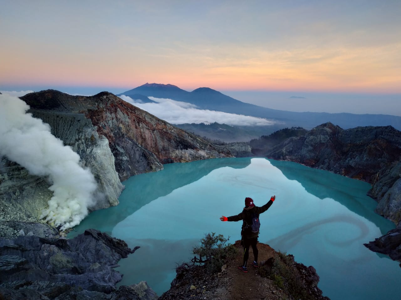
It is part of the Ijen Volcano Complex, a group of stratovolcanoes inside a larger caldera. Ijen is famous for its turquoise-colored acidic crater lake, which is the largest of its kind in the world. The volcano is most famous for the electric-blue flame that issues from cracks in the volcano at night. The flames are the result of combustion of sulfuric gases that emerge from the volcano at high pressure and temperature. The sulfuric combustion is visible only in darkness, making the midnight trek a unique experience. Local sulfur miners work in extreme conditions, carrying heavy loads of sulfur up the steep crater walls. Their resilience and the stunning natural phenomena make Ijen one of Java's most compelling destinations.
What makes it remarkable
SO₂ Combustion Phenomenon
One of only two places on Earth where sulfuric gas (SO₂) ignites into electric-blue flames (~600°C). Visible only in darkness, between midnight and sunrise.
World's Largest Acidic Crater Lake
Turquoise crater lake with pH as low as 0.2 — the world's largest by volume. Sulfur miners carry 70–90 kg loads from the crater floor daily.
Trail Access via Paltuding Gate
Trek begins at Paltuding Gate (1,800 m). Total: 3 km ascent, 750 m elevation gain. Crater rim at ~2,386 m. Round trip 4–5 hours. HPWKI-licensed guide mandatory.
Milky Way Visibility
Clear night skies offer spectacular Milky Way views from May to September — visible on the ascent before moonrise.
Sulfur Mining Culture
Observe traditional sulfur miners extracting and carrying sulfur blocks in extreme conditions
Sunrise Panorama
Experience breathtaking sunrise views over the crater lake and surrounding mountains
Trek & terrain profile.
Difficulty
Moderate to Hard
Distance (full GPS route)9.0 km
Elev. gain (full route)+797 m
Max elevation2379 m
Min elevation1872 m
Loading 3D terrain…
Route data: AllTrails.com · 3D terrain via Mapbox
On the trail
3km ascent (1.5-2 hours) to crater rim, 1km descent (30-45 mins) to crater floor. Steep gradient (30-40°), volcanic gravel surface.
What to bring
gas maskheadlamphiking bootswarm layersgloveswaterproof jacket
wind speed
10-25 km/h
humidity
70-95 %
air quality index
150-300
uv radiation
8-11 index
visibility
1-10 km
Police-led · private · verifiable
Why JVTO for Ijen Crater.
Police-led
Founder Mr. Sam (Bripka Agung Sambuko) is an active Tourist Police (POLPAR) officer for Bondowoso. Route decisions answer to police protocol, not marketing metrics.
Authority100% private
Your own vehicle, driver, and crew — no shared jeeps, no strangers, no compromise on timing or pace.
PrivateAll-inclusive
Transport, entrance fees, accommodation, water, and T-shirt bundled. No surprise local payments on the day.
Written inclusionsVerifiable
NIB 1102230032918 checkable at OSS. POLPAR, BBKSDA, and HPWKI credentials listed. Every document publicly verifiable before you pay.
Proof libraryBook your trip
Ijen Crater tour packages.
From Surabaya
Ijen Crater from Surabaya
Midnight departure. Private vehicle, sunrise at the viewpoint, dedicated crew throughout.
View packagesFrom Bali
Ijen Crater from Bali
Cross-island private package. Bali pickup, East Java circuit, return or drop at your next stop.
View packagesMulti-destination packages (3D2N to 6D5N) also available · See full list
Plan your day
Practical information.
Best season
April–October
Temperature
5-10°C at night, 15-25°C during day. Warm layers are recommended — wind chill at viewpoints is significant regardless of daytime temperatures lower down.
Physical requirements
Good physical condition required for steep ascent and high altitude. Not recommended for people with respiratory or heart conditions.
Visitor tips
Hotel departure 00:00, trek start at Paltuding trailhead 02:00, reach blue fire before 04:00, sunrise 05:00–06:00. Start trek at midnight (01:00 AM) for crater lake viewing, bring multiple warm layers as temperatures drop to 5°C, wear sturdy hiking boots with good grip, carry headlamp with extra batteries, acclimatize to altitude if coming from sea level, hire local guide for safety and cultural insights
Cultural context
Locals view Ijen as 'Gunung sing urip' — the living mountain. The Tenggerese and Osing communities consider the volcano sacred and make offerings during the Javanese month of Suro for protection and gratitude. The sulfur miners, known as 'Wong Ijen', have worked the volcano for generations, developing unique cultural practices around their dangerous profession. The volcano represents the element of Fire in Javanese cosmology - symbolizing power, creation, and purification. The blue fire (api biru) phenomenon occurs when sulfuric gases emerge from vents under pressure and ignite on contact with air, burning electric blue. Visible only in darkness — typically midnight to pre-dawn. A natural phenomenon: not guaranteed on every night, affected by gas flow and weather conditions.
Safety notes
- Gas mask mandatory near crater - sulfur dioxide levels can be dangerous
- Stay on marked paths and follow guide instructions at all times
- Carry sufficient water and energy snacks for the trek
- Wear appropriate hiking shoes with good grip
- Complete health screening as required by JVTO safety protocols
- Avoid visiting during high wind or rain which can concentrate toxic gases
- Sulfur miners have right of way on the trail — yield and do not photograph them without asking
- Health certificate is mandatory — no valid cert, no crater entry (BBKSDA SE.35/K2/BIDTEK.1/KSA/1/2024)
Risks and how JVTO handles them
health · Risk level: high
Toxic sulfur gas exposure causing respiratory issues
What JVTO does about it: Use provided gas masks, limit time near active vents, immediate descent if feeling unwell. JVTO provides professional equipment and health screening.
terrain · Risk level: medium
Steep, slippery paths especially in darkness
What JVTO does about it: Use headlamps, trekking poles, and proper footwear. Follow guide closely. JVTO guides are trained in night navigation.
weather · Risk level: medium
Rapid weather changes and cold temperatures at night
What JVTO does about it: Bring warm layers, rain jacket, and check weather forecast. JVTO monitors conditions and may adjust timing.
health · Risk level: medium
High altitude and physical exertion
What JVTO does about it: JVTO conducts pre-ascent health screening. Guests must disclose relevant medical conditions.
Weather by season
Dry season (Apr-Oct): Clear skies, minimal fog. Wet season (Nov-Mar): Frequent rain, dense fog, higher gas concentration.
- Guide required
- Yes
- Rainfall
- High during wet season (200-400mm/month), Low during dry season (50-100mm/month)
- Local communities
- Osing, Java, Madura
- Trail start point (longitude, latitude)
- 114.22426, -8.07316
Included on all Ijen Crater packages
- Private AC transport (fuel, tolls, parking)
- Dedicated driver and English-speaking guide
- BBKSDA national-park entrance fees
- Daily mineral water · JVTO T-shirt
- Accommodation & breakfast (overnight packages)
Not included
Flights · gratuities (guest discretion) · personal expenses · optional horse riding arranged on-site where available.
Permit & entry
Available at Paltuding entry gate. JVTO includes all entrance fees.
Visit Ijen Crater with JVTO.
Health Certificate Coordination
A health certificate is required for Ijen crater access under BBKSDA SE.35/K2/BIDTEK.1/KSA/1/2024. JVTO coordinates the health-screening workflow with Dr. Ahmad Irwandanu (STR QN00001073380217), included in your package and done at your hotel the evening before; the BSrE-signed certificate is checked at the crater access gate.
How Ijen Health Screening Works →◆ Quick Answers
FAQ
Travel Guide
Ijen Health Screening →Related Destinations